
Browsing & Navigation
How to access and browse your point clouds in ATLAS
Load Point Cloud Data
There are 2 methods to access and subsequently navigate your Point Cloud data within the ATLAS viewer.
From the 2D GIS Interface
-
Within the 2D map view, locate the 2D polygon representing the bounds of your Point Cloud.
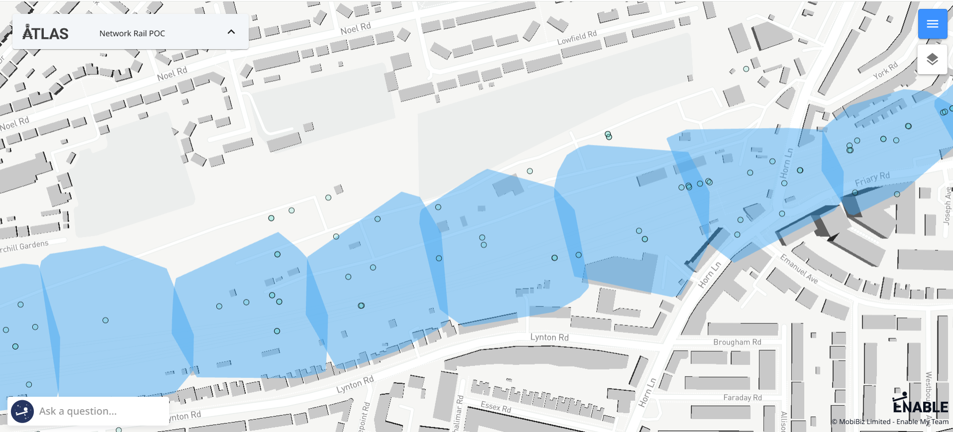
-
Click within the polygon, and select “Point Cloud” to open and load the file.
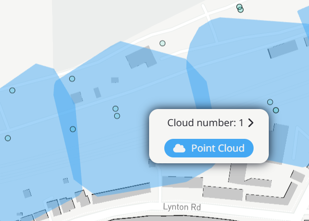
-
The point cloud will load within the 3D Viewer.
From the File Data Panel
-
After landing within the 2D map view, open the right hand Files panel by clicking on the blue menu button in the topr right of the window. If the panel doesn't open on the Point Clouds data (project specific settings), use the drop down menu to select 'Point Clouds'.
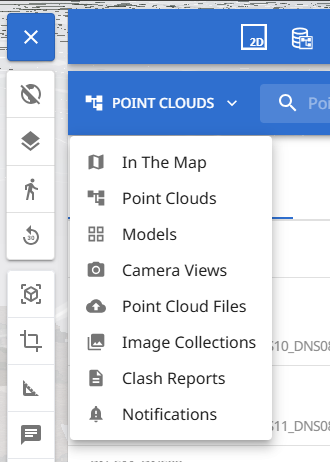
-
Locate the point cloud you wish to load and select “Zoom to”.

-
The point cloud will load within the 3D Viewer.
Navigating Point Clouds
ATLAS navigates on zoom, plan and rotate.
Scroll/Right Click = Zoom
Left Click and Drag = Pan
Middle Click/Crtl with Click and Drag = Rotate
Navigation for Linear Point Clouds
For point clouds covering large areas including long geographic corridors ATLAS optimizes their visibilty by dynamically loading and unloading data as you move around the point cloud within the viewer. This removes the need to manually load and unload data, giving a seamless experience.
First Person Mode

First person mode allows you to navigate the 3D environment as you are walking on ground level.
Click and Drag = change your line of site
W = move forward
A = move left
D = move right
S = move backwards
Point Cloud Styling
ATLAS offers many styling options for your point cloud display. The styling options can be found within the details panel on the left of the window.
Styling Options
- Light - displays the points as white
- Dark - displays the points as black
- Raw Elevation - shades the points in respect of their elevation data, the shading range is customisable.
- Intensity - shades the points in respect of their intensity data, the shading range is customisable.
- Asset Classification - block colours clusters of points based on their asset classification within the point cloud. Colours are customisable.
- EDL Shading - can be switched on/off and size adjusted. We recommend EDL Shading is turned on for RGB point clouds for a clearer view.
Point Size and Performance
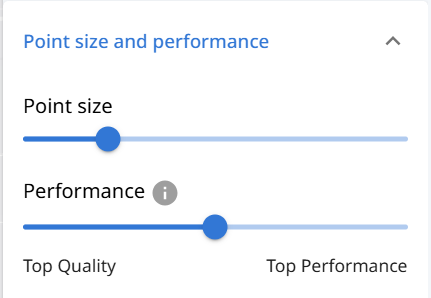
When loading a point cloud ATLAS auto detects the optimum performance level for your browser window for the balance of performance v render quality & point size. But these settings can be manually overwritten within the lefthand panel.
Updated 21 days ago